The dunam war: 'Israel’s' final push to annex the West Bank by 2026
- A 34-year bureaucratic and digital system has transformed land seizure in the occupied West Bank from “temporary” military measures into permanent civil ownership.
- The 2026 shift to land registration, known as Tabu, marks an irreversible phase of dispossession targeting Palestinian communities across Area C.
By: Rana Salahat
Behind the expansion from 900,000 dunams seized in the early 1990s to the planned “final registration” of 2026 lies a sophisticated state apparatus. It combines legal revivalism, military bureaucracy, high-tech surveillance, and a little-known mapping unit known as the “Blue Line Team”.
Over 34 years, this system has steadily converted Palestinian land into state property, moving from broad declarations to precision seizures and, finally, to permanent civil registration under domestic law.
1992–1993: The “Sultan’s ghost” after Oslo
By 1992, the ‘Israeli’ Civil Administration’s Custodian of Government Property had already completed what Palestinian researchers describe as the “Great Land Grab.” Around 900,000 dunams across the occupied West Bank were declared state land.
Read more: Over 20 countries, intl. bodies condemn “Israeli de facto annexation” of West Bank
This phase was shaped by the doctrine developed by Plia Albeck, then head of the Civil Department at the State Attorney’s Office. Albeck personally conducted helicopter surveys over the West Bank to identify land deemed “uncultivated.”
Her office revived provisions of the 1858 Ottoman Land Code, specifically the Mawat category. Under this interpretation, if a Palestinian farmer could not prove that at least 50 percent of the land had been cultivated continuously for 10 years, it was declared “property of the state.”
This legal maneuver laid the foundation for major settlement blocs such as Gush Etzion and Ma’ale Adumim and locked in territorial realities that persist today.
1993–2023: The Blue Line era of micro-seizures
During the three decades of the so-called peace process, land seizure did not stop. It became more technical and less visible.
Roughly 50,000 additional dunams were seized through the work of the Blue Line Team, a specialized GIS unit operating within the Civil Administration. Its task was to “correct” old maps by using modern GPS technology to identify gaps between historic state land declarations and the boundaries of Palestinian villages.
Read more: 'Israel' targets 15% of area C in West Bank in first major land registration since 1967
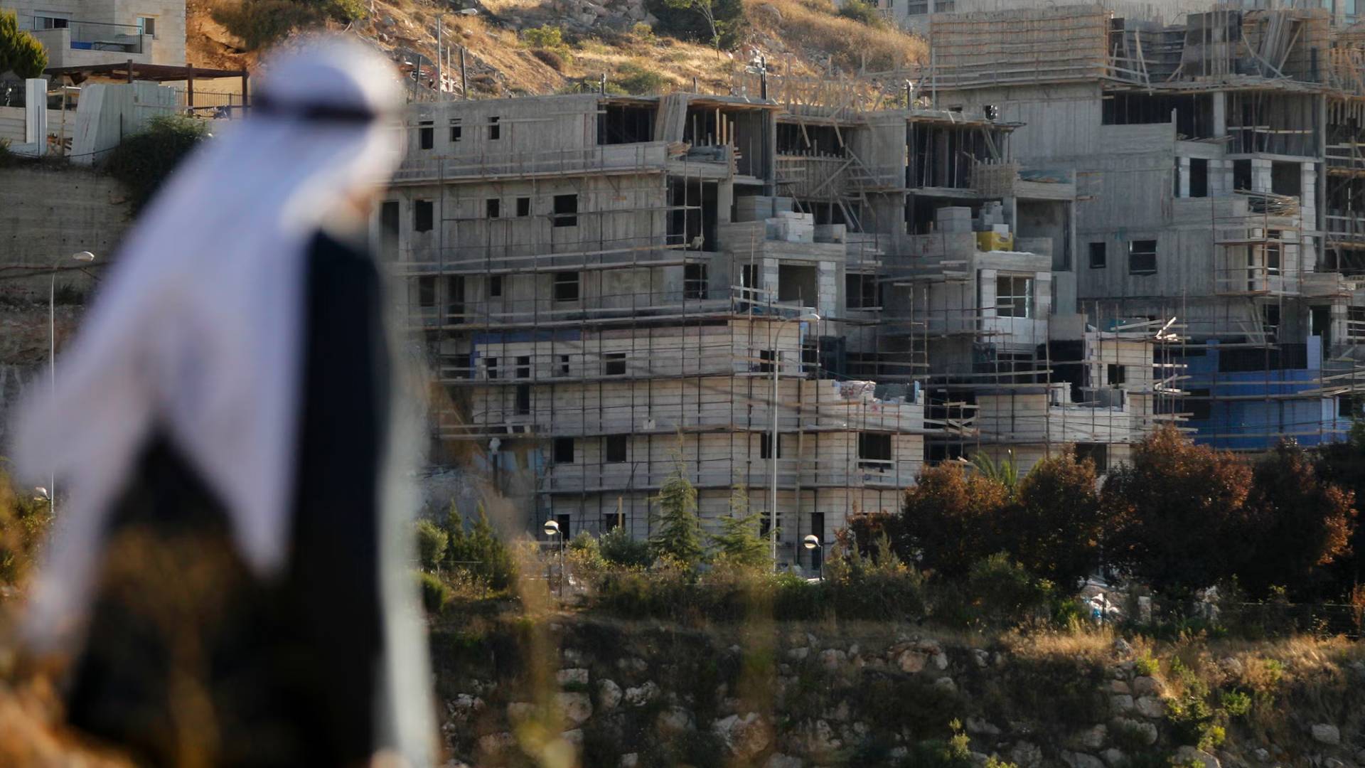
The E1 corridor offers a clear example. Over years, small patches of land were declared state property in a zigzag pattern between Jerusalem and Ma’ale Adumim. The cumulative effect blocked the expansion of the Palestinian towns of Al-Eizariya and Abu Dis and made a contiguous Palestinian state geographically impossible.
2024: Smotrich acceleration
The pace of seizure accelerated sharply in 2024.
Following the creation of a Settlement Administration inside the Ministry of Defense, under the political leadership of Bezalel Smotrich, long-standing bureaucratic restraints were removed.
In March 2024, ‘Israel’ announced the seizure of 8,000 dunams in the Jordan Valley, specifically in the Jiftlik and Aqraba area. It was documented as the largest single land seizure since the Oslo Accords and part of a total of 24,000 dunams declared that year.
The declaration was formally signed by the head of the Civil Administration at the time, Brigadier General Hisham Ibrahim. However, it was directed by the Settlement Administration’s civilian deputy, Yehuda Eliyahu.
The land belonged to the Palestinian villages of Aqraba and Majdal Bani Fadil. Residents say ancestral grazing areas were first converted into a closed military zone before being allocated to the Yafit settlement.
2026: Tabu finality ends the fiction of “temporary”
As of February 2026, policy has shifted from declaration to registration.
The ‘Israeli’ cabinet approved a NIS 244 million budget for the Land Registration Office to carry out land title settlement, known as Tabu, across Area C.
Unlike military declarations, which could theoretically be reversed by a future commander, Tabu is a civil legal process. Once land is registered in the Ministry of Justice’s records, it is considered sovereign state property under domestic law.
Officials involved describe the process as irreversible.
The focus in 2026 has shifted to the South Hebron Hills, particularly Masafer Yatta. By registering previously declared “state lands,” authorities are permanently displacing residents of 12 Palestinian hamlets, including Khirbet al-Majaz.
The residents are labeled squatters on state property, despite decades of documented presence and land use.
Anatomy of a disappearing map
The tools have evolved, but the outcome has remained consistent.
Before 1992, helicopter surveys and Ottoman-era law secured 900,000 dunams forming today’s core settlement blocs. Between 1993 and 2023, GIS mapping by the Blue Line Team added 50,000 dunams by closing cartographic gaps. In 2024, administrative orders under Smotrich’s authority seized 24,000 dunams, mainly in the Jordan Valley. In 2026, Tabu registration is set to permanently annex large parts of Area C.
The digital enclosure
What distinguishes the current phase is speed.
In 2026, ‘Israel’ is using AI-driven satellite monitoring, contracted through private ‘Israeli’ technology firms, to track agricultural activity across Area C. The system alerts the Civil Administration in real time the moment a Palestinian farmer attempts to plow new land.
Human rights researchers describe this as real-time dispossession. It eliminates the delay that once allowed farmers to establish cultivation and legal claims.
Analysts say this digital enclosure makes the current phase the most dangerous in a 34-year process that has steadily erased Palestinian land from the map of the West Bank.