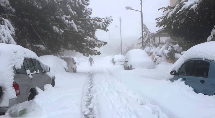
File photo of snow in Jordan.

Severe polar air mass to impact Jordan, Levant this weekend
Global and local meteorological centers are closely monitoring the impact of an intensely cold polar air mass expected to reach Jordan and the Levant by the end of the week – which could potentially bring snow to Jordan.
Starting Thursday, the polar air mass will begin affecting the region, bringing a sharp drop in temperatures and rainfall over northern and central Jordan, gradually extending to the southwestern and eastern regions. Strong westerly winds are also expected to stir up dust storms in desert areas.
According to ArabiaWeather, the frigid polar air mass is likely to settle over Turkey by the weekend, triggering the formation of a low-pressure system that will influence Jordan on Thursday and Friday.
Temperatures are expected to drop significantly, with rainfall in several areas, possibly accompanied by hail showers.
While polar winds will continue flowing into Jordan and the Levant after the passage of the low-pressure system, widespread snowfall is not anticipated in Amman or most regions. However, higher mountain elevations may experience limited snowfall, according to ArabiaWeather.
Jordan braces for snow, rain, strong winds
Jordan’s Meteorological Department (JMD) has named an incoming severe polar cold front “Al-Jalmoud,” reflecting its harsh and frigid nature. The name, which means "boulder," signifies the wave’s intense impact on the region.
Expected Impact
According to Raed Rafed Al-Khattab, Director of the Meteorological Department, the cold front will reach Jordan and the eastern Mediterranean by the weekend and early next week, bringing:
- Sharp drop in temperatures due to an Arctic air mass
- Scattered rainfall, mainly in western Jordan
- Strong winds, especially in open areas, stirring up dust in desert regions
- Snow showers on Saturday over high-altitude areas in northern and southern Jordan
Snowfall chances may improve late Sunday into Monday morning, potentially covering high elevations in northern, central, and southern Jordan, as well as eastern highlands. However, exact accumulation levels remain uncertain.
Public Advisory
Al-Khattab emphasized that meteorologists are closely monitoring the system and urged the public to stay updated with forecasts and take necessary precautions, especially in areas prone to heavy rain, snowfall, and strong winds.
Jordan Meteorological Department issues weather update
The Jordan Meteorological Department (JMD) forecasts significant weather changes over the next three days, with cold conditions, scattered rain showers in some areas, and the impact of a polar air mass.
Wednesday, February 19, 2025
The weather will be relatively cold in most regions, while the Jordan Valley, Dead Sea, and Aqaba will experience warmer conditions with high-altitude clouds.
Winds will shift from southeasterly to northwesterly by the afternoon.
By late night, cloud cover will increase, bringing scattered rain showers to western parts of the country.
Warnings for Wednesday:
- Reduced horizontal visibility due to dust in desert areas
- Fog formation over high mountain elevations late at night
- Risk of slippery roads in areas experiencing rainfall
Thursday, February 20, 2025
A very cold polar air mass will gradually impact the country, causing a sharp drop in temperatures.
The weather will be cold, cloudy, and rainy across northern and central Jordan, as well as parts of the southwestern region, with heavy rainfall at times, increasing the risk of flash floods.
Scattered showers are also expected in the eastern regions by the afternoon.
Strong westerly winds, with gusts exceeding 65 km/h, will stir dust, particularly in the eastern and southeastern areas. By night, rainfall intensity will decrease, and wind speeds will gradually subside.
Warnings for Thursday:
- Risk of flash floods in valleys and low-lying areas, including the Dead Sea
- Poor visibility due to dense dust, especially in the southeast and east
- Strong wind gusts in open areas
- Low visibility due to low-hanging clouds over high mountain elevations
- Risk of vehicle skidding on wet roads
Friday, February 21, 2025
Temperatures will continue to drop, with very cold conditions and partly to mostly cloudy skies. Scattered rain showers are expected across northern and central Jordan.
By evening, rain may extend to parts of the southwestern and eastern regions.
Northwesterly winds will remain active, with occasional strong gusts stirring dust in the eastern and southeastern areas.
By late night and early Saturday morning, light snow mixed with rain may fall on the highest mountain peaks in the north.
Warnings for Friday:
- Poor visibility due to low clouds over high mountain elevations
- Reduced visibility due to dust in eastern and southeastern regions
- Strong winds and gusts in open areas
- Risk of vehicle skidding on wet roads
Public Advisory:
Citizens are advised to take necessary precautions and exercise caution while driving, especially in areas experiencing heavy rain or strong winds.
Snow or rain? Latest weather models show conflicting forecasts for Jordan
The latest morning updates from ArabiaWeather on Tuesday, February 18, 2025 (10:30 AM) indicate significant changes in the movement of the polar air mass and its expected impact on the region. Global weather models remain divided on the system’s exact path, making the upcoming weather conditions complex and subject to change in the coming days.
1. European Model (ECMWF): Extended Impact and Snow Potential
The European model suggests the polar air mass will initially retreat northward as it moves over the eastern Mediterranean on Saturday, February 22. However, there is a strong possibility of a secondary shift over Turkey, allowing the cold air to re-intensify over the region by late Sunday into Monday. It forecasts:
- Precipitation starts Saturday night into Sunday, improving throughout the day and extending into Monday
- Snowfall is expected primarily over southern highlands, with scattered and inconsistent flurries elsewhere
- A rainy low-pressure system is expected Thursday and Friday ahead of the polar air mass
2. GFS Model: Similar Scenario with Variations in Precipitation
It forecasts:
- Rain on Thursday and Friday
- Brief northward retreat of the cold air on Saturday, followed by a secondary push over Turkey, leading to renewed intensity Sunday night into Monday
- Renewed rainfall on Saturday, with snow showers over high southern peaks
- Weaker precipitation on Sunday, but improving again by Sunday night into Monday
- Snowfall remains most likely in the southern highlands, with only sporadic flurries elsewhere
3. German Model (ICON): Most Optimistic with Widespread Snowfall
The model presents a more favorable scenario, predicting a direct push of the polar air mass into the eastern Mediterranean:
- Widespread snowfall overnight Saturday into Sunday
- Heavy snow accumulations over southern highlands, making it the most optimistic forecast
4. Canadian Model (GEM): Weaker Snowfall Outlook
This model has downgraded its snow forecast compared to previous runs:
- The polar air mass moves away more quickly to the northeast, reducing both rain and snow potential
- Only scattered snow showers Saturday night into Sunday
5. UK Model (UKMET): Similar to the Canadian Model
This model mirrors the Canadian model, suggesting:
- Rapid withdrawal of cold air northward before fully reaching the region
- Limited rain and snow potential, making it one of the least intense forecasts
Expert Analysis: Key Changes in Weather Patterns
ArabiaWeather experts highlight two major factors influencing the forecast:
- Westward shift in the polar system’s trajectory may prolong its impact over Turkey before pushing back toward the region
- Faster-than-expected retreat could weaken the overall storm effect, limiting snowfall except in the highest southern elevations
What’s Next?
There is initial agreement among models that southern areas will likely experience significant snowfall from late Saturday into Tuesday due to an influx of extremely cold polar air.
Icy and freezing conditions are expected, with potential low-elevation snowfall in some cases.
However, uncertainty remains high due to the complex atmospheric setup, and the final details may change in the coming days.
Recommendations & Warnings
- Stay updated with daily weather forecasts for potential changes.
- Prepare for extreme cold, especially in elevated areas.
- Take necessary precautions against frost and freezing conditions, particularly in southern regions.
ArabiaWeather Center will provide more accurate forecasts starting tomorrow as models refine their projections, offering a clearer picture of the polar air mass’s trajectory and potential impacts.
Major shifts in weather; under close monitoring by meteorologists
Significant atmospheric changes in the upcoming weather system have been detected by ArabiaWeather, according to the latest evening (12z) computer model updates, which show notable differences compared to morning forecasts.
The most critical change involves a westward shift in the geographic trajectory of the polar air mass, which could impact the nature and distribution of the expected low-pressure system over the coming days.
Key Weather Developments
Meteorological analysis suggests that the cold air mass is now projected to move further toward the eastern Mediterranean waters. Some models indicate a deeper incursion into this area, a phenomenon observed during past storms such as "Jana" (February 21, 2015) and "Alexa" (December 12, 2013), which triggered a low-pressure system off the Lebanese coast, resulting in varying degrees of snowfall.
However, discrepancies remain among weather models, with some diverging significantly from this scenario. Experts caution that further updates in the coming days will be necessary before confirming any final forecasts.
What to Expect After Sunday
Despite uncertainty regarding the final trajectory, weather models currently agree that southern regions of Jordan could see significant snowfall starting Sunday, as intensely cold polar currents push into the region. The coldest period is expected between late Saturday and Tuesday, accompanied by severe frost and icy conditions.
Monitoring & Weather Alerts
Meteorologists stress that the path of the polar air mass remains complex and subject to change, as surrounding atmospheric factors significantly influence the movement of the low-pressure system. Given the high variability in climate data, pinpointing an accurate forecast at this stage remains challenging, and further adjustments are likely as the weather event approaches.
ArabiaWeather said its proprietary numerical models will provide more detailed tracking of this weather system starting tomorrow, helping refine impact forecasts and affected areas.
Residents are urged to stay updated with the latest weather bulletins, as further adjustments to the forecast may occur in the coming days.